
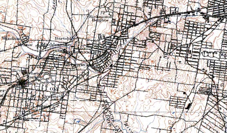
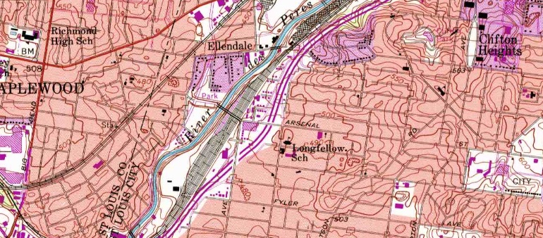
Maplewood resident Steve Terelmes recently shared seven topographic maps with 40 South of an area that includes Brentwood (called Maddenville in the 1912 map), Maplewood and Richmond Heights showing how the area has progressed.
The maps are from the years 1912, 1933, 1950, 1968, 1974, 1993 and 1998.
Click on the link. You can zoom there
I wish I could see these blown up at a bigger size.
Gary, the link above these maps will take you to an enlargable PDF.
Thanks, Doug. I overlooked the link. Now I see it.
Comments are closed.