
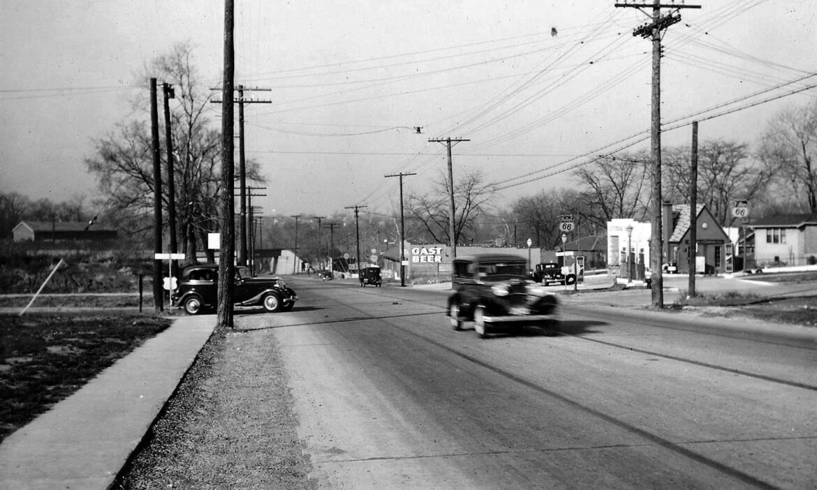
Don’t you love images like this one? It is a stretch of Manchester that is familiar to all of us who live in or near Maplewood. Recognizable but almost completely different from the way it looks today.
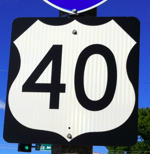
We are looking west down Manchester. The intersection is that of Laclede Station Road. I have never seen an image of the cool filling station that was once on the northwest corner. Notice that it is a Phillips 66 station. The 66 was for Route 66, the mother road that ran straight through Maplewood.
The cars are from the mid-1930s. The original Route 66 was so designated from 1926 through 1933. This image is almost certainly of the original Route 66. Perhaps by the time this photograph was taken the alignment (as they are known) had been moved to Watson a couple of years earlier. No matter. The view wouldn’t have changed much.
The NE corner today is the location of the Aldi’s supermarket. The Volvo dealer occupies both the SE and the SW corners.
Much thanks to my former neighbor, Bill Smothers, for sending this along.
Doug Houser September 19, 2021
Ironically the building advertising “Gast Beer” is the same building there today, I don’t know what it was, but back in the 60’s and 70’s it was the “Pearl” tavern.. so it seem beer runs deep.
So what’s the little two-armed gizmo hanging from the wires over the roadway?
It’s a street light. Usually, they were used only at intersections.
Great photo. Good to know it is looking west. The highway signs look like they are in the shape of federal highway signs, and the new sedan pulling onto Manchester could be a model as early as 1933. So, it just MIGHT be Route 66 in 1933. Unless someone sees evidence to the contrary that would make that impossible.
That’s a good catch, Hammerhead, the shape of those highway signs. If my former neighbor, Bill, could come up with a higher resolution image we might be able to make out the one on the westbound side of the road. If it had 66 on it, it would be just the 3rd Maplewood photograph I have ever found with a 66 sign image in it.
From Wikipedia: “According to the Phillips Petroleum Company Museum in Bartlesville, the “Phillips 66” name for the gasoline came about by a combination of events.[9] The specific gravity of the gasoline was close to 66; the car testing the fuel did 66 miles per hour; and, the test took place on US Route 66.[9] So, the naming committee unanimously voted for “Phillips 66.”
I could swear we learned at Philmont that it was the 66th well that worked or something.
Hey George, I am trying to remember where I heard that the 66 in Phillips 66 was for the highway. It might have been at the Route 66 museum at what used to be Times Beach. I included that information from my memory. I get in more trouble that way.
On the left top is a large building. It looks like a barn or a factory or maybe something to do with the train tracks that cross Manchester there. Any idea what that was? I am not originally from here but do not recognize Gast Beer. That a local brand? And is that building still there today? Doesn’t seem possible but the current building goes down the hill also I am thinking.
The building approximately in that Gast Beer ad location was built in 1925, so probably the same building.
I wondered about that large building too, Mark — possibly Sunnen?
I don’t have a guess as to what was in the large building, either. I’m not sure what year Joe Sunnen bought that property. I don’t have any information on Gast Beer, either but remember seeing it advertised on the window of the building on the NW corner of Hazel and Sutton in another one of our historic photographs.
Gas stations sure were quaint in those days.
Ain’t that the truth? Compare this one to the new QT. Looks like this vintage one had 3 pumps compared to QT’s how many? I’m guessing that two of those pumps were regular and ethyl. Do you think the 3rd was diesel?
did they have diesel way back then? I thought I remembered my dad saying that some of the early tractors would use Kerosene instead of gasoline. I am not a chemist but it seems like kerosene and diesel might be closely related. Both certainly feel much more oily than gasoline.
Comments are closed.