
At least a couple old maps of Maplewood are on public display. One is at city hall and another is at John Stricker Auto Repair, at 7416 Manchester Road.
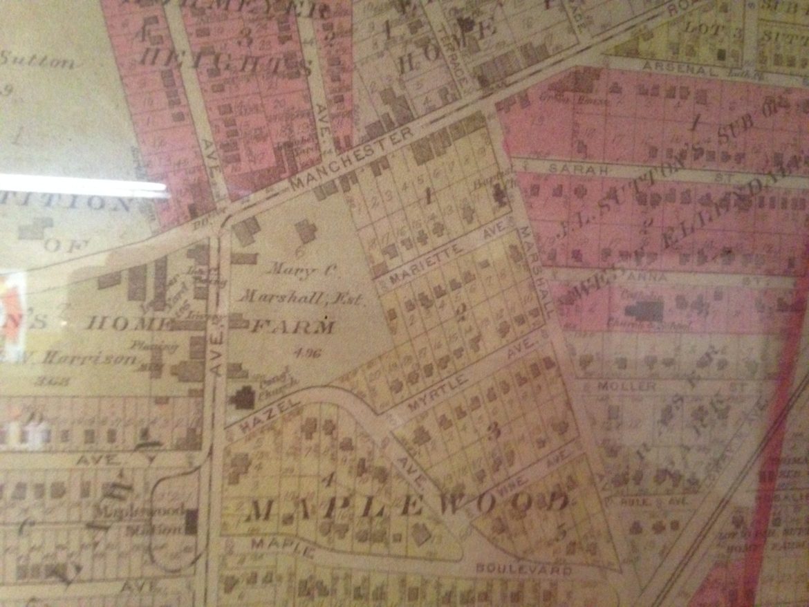
It’s interesting to see how street names have changed, like Big Bend north of Manchester was Pennsylvania; and Marietta Avenue was Marriette, and it was half as long, ending at the Mary C. Marshall Estate.
No date is apparent on the map.
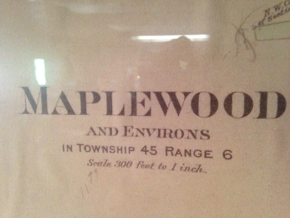
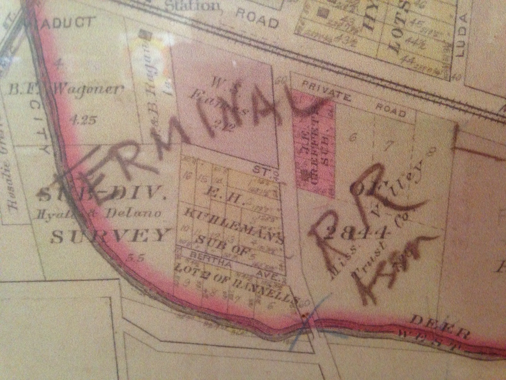
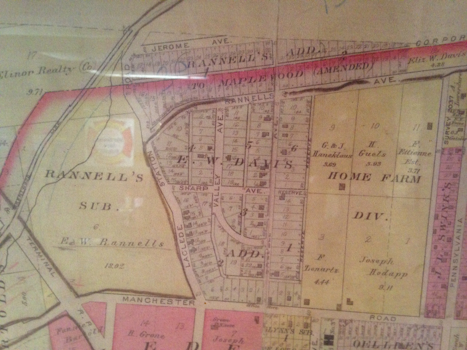
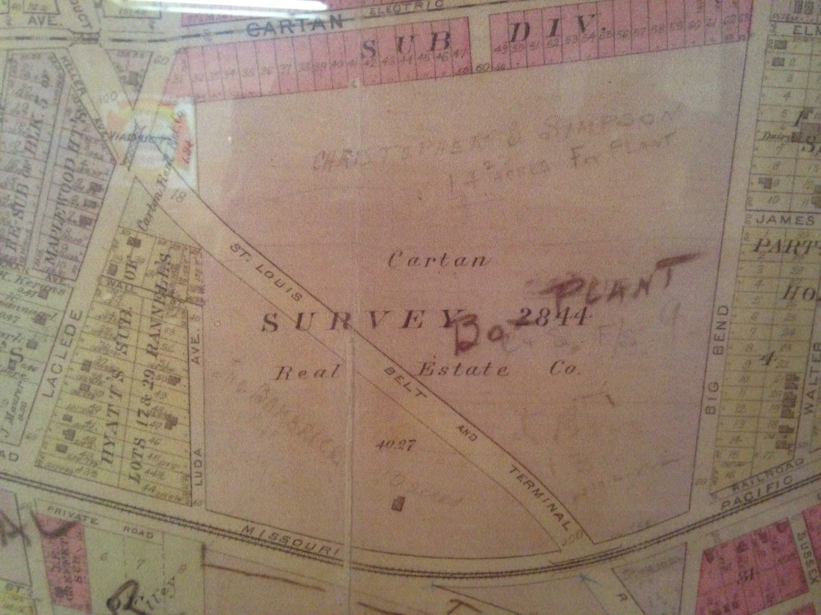
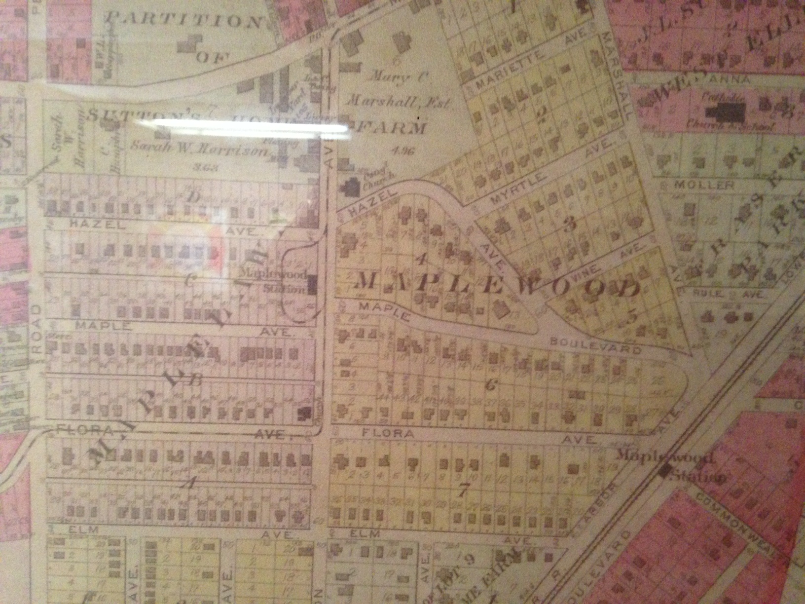
The map is none other than the Maplewood map from pages 54 and 55 in the 1909 Plat Book of St. Louis County. An original of which I have hanging on my wall directly behind me as I type. The same is hanging in the Maplewood council chamber. The copy in Strickler Automotive is identical to one I got from a neighbor of Millie Durban’s over on Burgess whose name escapes me at the moment. I recognize the Terminal RR scrawl. Well worn copies of the entire 1909 Plat Book of St. Louis County can be found in the reference rooms of the Headquarters Branch of STL Co Library and the Main Library in downtown STL. I recommend going to the latter because, if you haven’t seen it already, you’ll be stunned by the beauty of that building much enhanced since the renovation.
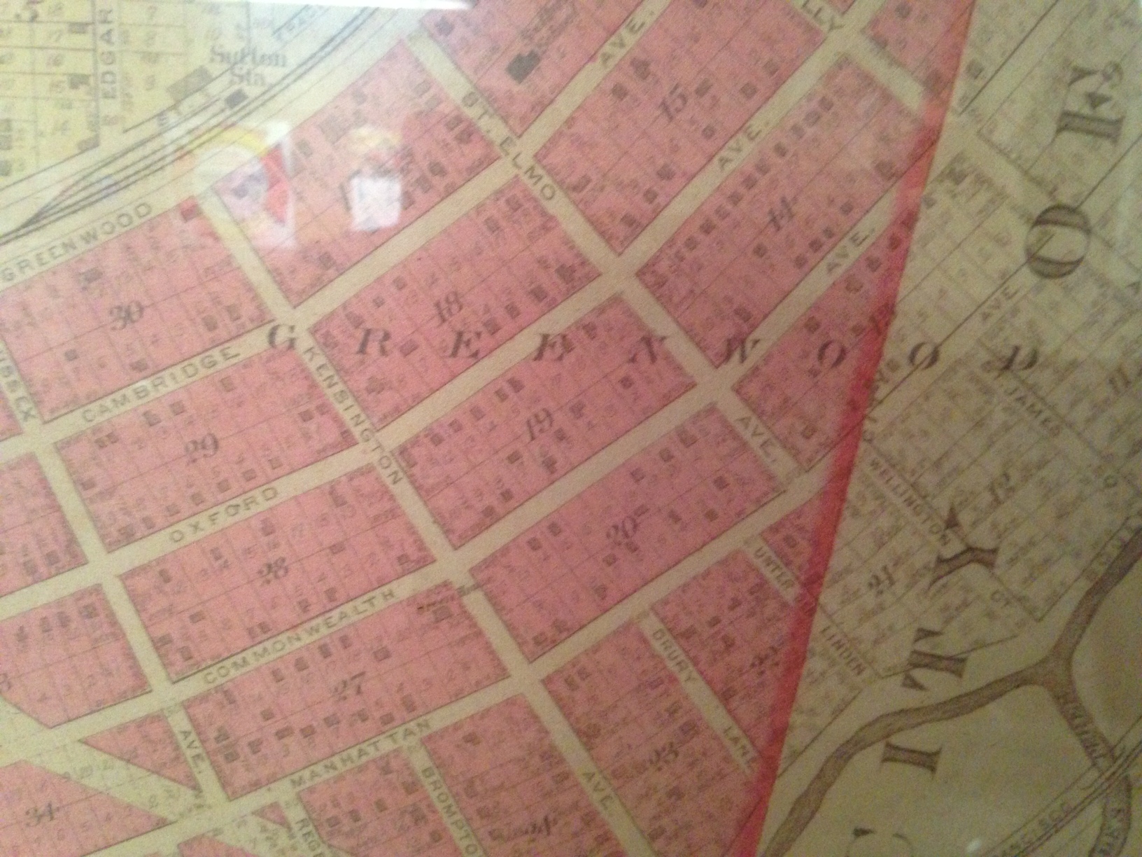
As for GREENWOOD, look no further. https://40southnews.com/maplewood-history-interesting-and-historic-greenwood-subdivision/
What about the part of Maplewood north of Manchester and east of Big Bend (Pennsylvania)? I don’t see it.
Also it looks like what is now Southwest Ave was called Arsenal then.
I want to be a landowner and have a subdivision named after me. I did see a few names that I did not know. Saw a Davis and a E H Kuhlmans that I do not know anything about. Did see Mary Rannels Farm site. Doug you know anything about those names.
As for the English names I wonder if it is maybe competition with University City to have some really neat sounding names, or if you just some day run out of names for streets. Seems like every town has some of the same names like Washington or Main or First Street.
Here’s a little on Mary Rannells. https://bit.ly/2MjHwL4 and https://bit.ly/1oI9VGO
So many of the street names South of Greenwood have a connection with England.
I wonder if the developer was from England?
Comments are closed.