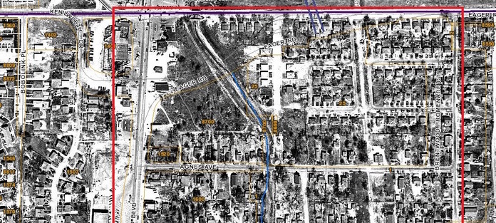
On Twitter, @DigitizingStl posts historic public documents that relate to St. Louis. He recently posted aerial photos in the Brentwood, Maplewood and Richmond Heights areas that show the effects of development 1937 – 2015. Neighborhoods disappear, city dumps become retail areas.
The historical aerial photos are from the St. Louis County website.
https://twitter.com/PubPolHist/status/771573149112471554
https://twitter.com/PubPolHist/status/771571521676451840
https://twitter.com/PubPolHist/status/771584062599200768
https://twitter.com/PubPolHist/status/771586490111373312


In case anyone didn’t know, STL County has an interactive map on their website, which lets you view historical aerial photos all the way back to the 1930s. http://maps.stlouisco.com/propertyview/